NDS Drone Surveys
General information
Drones have become a cost effective tool to survey and monitor a variety of targets. Not only can small drones be used for video photography but also for the acquisition of aerial photography.
In conjunction with the relatively low flight heights, drones produce very detailed aerial imagery of an area. These images can be imported by the end user in order to conduct required analysis or other tasks. The end products are compatible with easy to use software and applications, such as Google Earth.
Through cloud based machine learning such images can further be analysed to determine additional parameters, such as elevation, heights of objects or the ground, outgoing thermal radiation and other parameters. These processes can also produce detailed three-dimensional models of objects.
All results can be exported into data formats compatible with more specialized software for further analysis, e.g. architectural drawing programs etc.
Services we offer
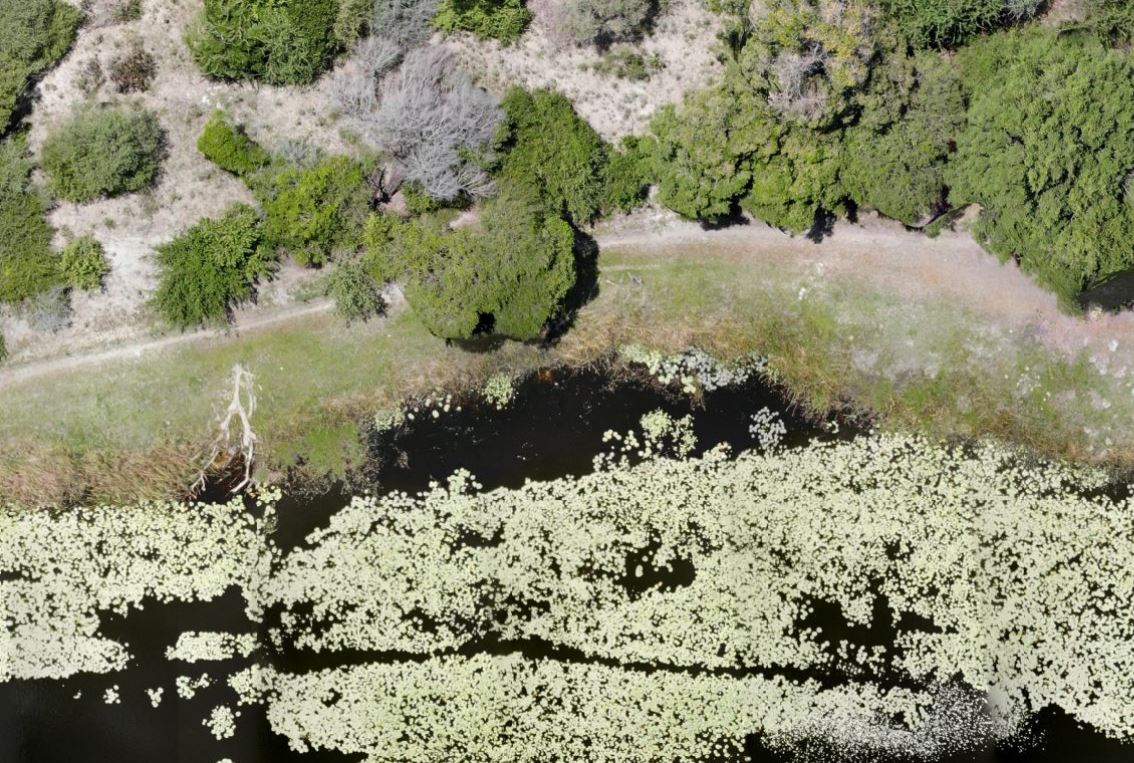
High resolution aerial photography along the Thamalakane River
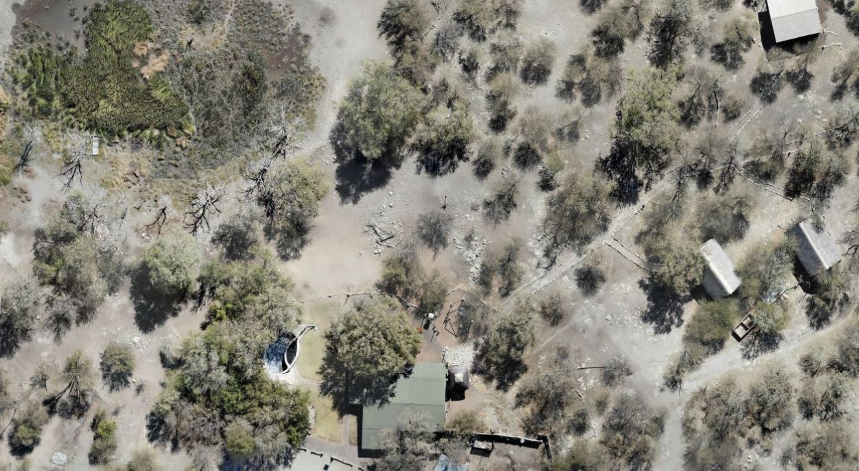
High resolution aerial photography of a tourist facility
|
General survey flights
Our general survey flights are targeted to an audience with interest in the acquisition of ad-hoc aerial photography. The produced imagery is compatible with readily available applications, such as Google Earth, Photoshop etc., where clients can use our images for the purposes of measuring, drawing, planning or simply for pleasure. With our fleet of drones, the available accessories and software, we are able to offer quick, cost effective and accurate services to our costumer. Image acquisition can be arranged for smaller areas, such as plots, and the developments on them as well as for larger areas, e.g. large agricultural fields, small ranches etc. These images provide an excellent platform for most construction developments, planning and management. Further processing of these high resolution aerial photographs provides the basis for stocktaking, machine learning algorithms enable us to conduct quantitative assessment of features easily identifiable in the imagery. Aerial photography can be used to count objects automatically, objects, such as livestock, trees, materials we are also capable to easily effectively conduct volumetric measurements as the basis for the planning and cost benefit analysis for mass movement, e.g. the movement of rocks, sand etc.. |
|
Repetitive Vegetation Monitoring Flights
By using our aerial photography, one can examine vegetation health and monitor vegetative stress. This is essential for modern and effective agricultural management. Imagery, combined with the help of GPS can be used to pinpoint to areas where stress occurs. Further assessment reveals if the stress is induced by various parameters, such as lack of specific plant nutrients or water. Using regular monitoring flights, enables a farmers to effectively and with pinpoint accuracy manage their crops. |
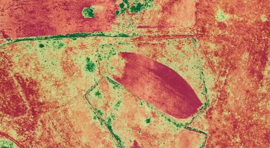
Vegetation health map of agricultural fields
|
A digital surface model can be used to determine flood risks, find optimal positioning of water supply lines.
|
Elevation survey flights
Manual survey of elevations is a labour intensive and therefore very costly endeavor. We offer quick and reliable solutions using photogrammetry. Aerial photography is acquired by our drone and provides almost instantaneous results, compatible with a variety of high end software (e.g. CAD or GIS program) and easy to use web based applications, such as Google Earth. Our company provides the costumer with digital surface models and/ or digital terrain models (trees, houses, cars removed). Our models provide valuable input into our customers planning processes, mainly for construction and irrigation, however there are any many other applications. Repetitive monitoring enables the calculation of stockpiles, forecast of costs associate with earth moving processes etc. Ask for specific information. Upon request, our team of experts is available to provide these analysis for you. |
|
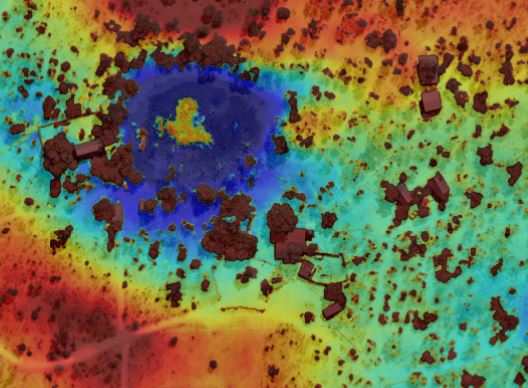
Thermal imagery
While thermal imagery is often used in emergency response scenarios, it also provides valuable information for agricultural production, the inspection of technical facilities and building. Areas of high soil moisture content can easily be determined by the use of thermal imagery. While this kind of imagery also provide valuable information for the inspection of technical equipment, such as transmission towers, power lines etc., thermal imagery can also be used for the assessment of energetic efficiencies of buildings. |
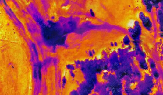
Thermal imagery used to determine soil moisture for agricultural production
|
3D modeling
3D modeling is not only a powerful visual tool but can be used for a variety of applications, such as the technical survey of existing, structures, such as buildings. The results are compatible with standard architectural software, e.g. a variety of CAD programs and form the basis of surveys and further advanced architectural assessments, such as dimensional measurements. For smaller objects, these 3D models can be used as the basis to produce a 3D printed model of the object.
3D modeling is not only a powerful visual tool but can be used for a variety of applications, such as the technical survey of existing, structures, such as buildings. The results are compatible with standard architectural software, e.g. a variety of CAD programs and form the basis of surveys and further advanced architectural assessments, such as dimensional measurements. For smaller objects, these 3D models can be used as the basis to produce a 3D printed model of the object.
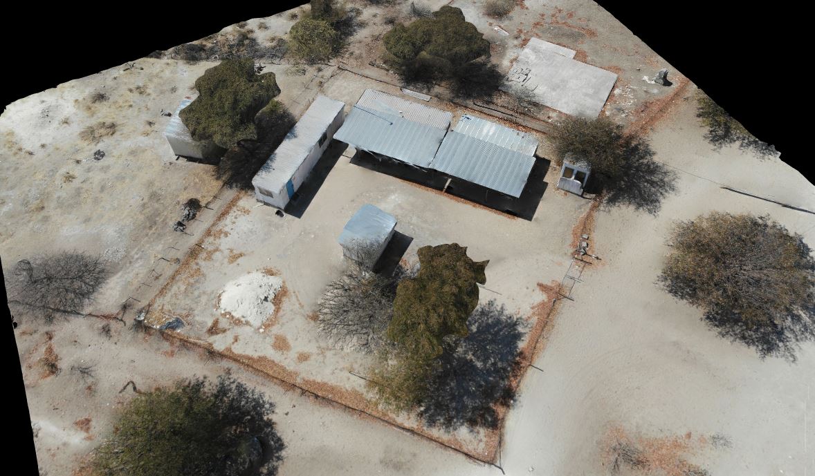
3D model of an office complex
|
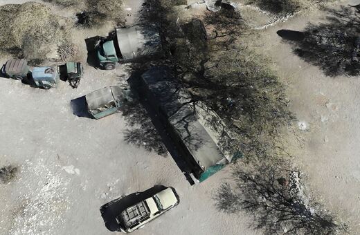
3D model of a tourist camp
|